Chincoteague NWR is located on the southern Virginia end of the barrier island of Assateague. The refuge attracts large numbers of waterfowl, herons, ibis, ospreys, shorebirds, warblers, and other migrants. It is also the home to wild horses, deer, raccoon, fox squirrels, and other animals. Used to being protected, the wildlife is unusually tolerant of humans and presents visitors with great photo opportunities. The ocean, dunes, shells, workboats, harbor, and spectacular sunrises and sunsets offer workshop participants a variety of subjects with which to work. The program includes tips on locating and approaching wildlife, capturing in-flight shots of birds, equipment selection, composition, lighting, and exposure. We will explore both the refuge, seashore, and the community.
Special feature – Saturday afternoon pontoon boat trip along Assateague’s/Chincoteague’s shoreline with the hope of photographing wild horses, wading birds, porpoise and other wildlife. (weather dependent)
Because of the small class size (8), this Chincoteague Photo Workshop is the perfect blend of one-on-one assistance in the field, instructional PowerPoint presentations, and image critiques.
Sanderling twisted preening.
Great Egrets landing in tree.
Friday
7:00 PM-8:15 PM (orientation)
Saturday
Sunrise to 9:30 AM (photography @ Chincoteague, Assateague Island, and surroundings) 9:30 AM – 11:30 PM (image editing and lunch break) 11:30 – 1:00 PM (discussion/critique of workshop images)
1:00 PM til Sunset (Boat Trip & Sunset)
Sunday
Sunrise to 10:00 AM (photography @ Chincoteague, Assateague Island, and surroundings) 10:00 AM – 12:00 PM (image editing and lunch break) 12:00 – 2:00 PM (discussion/critique of workshop images)
Orientation, meetings, & critiques will be held at the Best Western Plus Motel, Chincoteague Island, VA.)
Osprey taking off
Ocean Sunrise nice color and layers
Description:
This Chincoteague Photo Workshop is designed for those with a basic knowledge of the operation of a 35 mm SLR digital or mirrorless camera with an interest in nature. Workshop emphasis is on improving photographic skills and optimize the use of your camera. Class includes an orientation PowerPoint program followed by photography sessions on Chincoteague National Wildlife Refuge, Assateague Island, and in the town of Chincoteague. Included is a critique/review of images from the weekend. Topics covered: 1) equipment selection and operation, 2) composition, creativity and perspective, 3) metering and exposure, 4) lighting, 5) basic image manipulation and 6) locating, approaching and photographing wildlife.
Fog at sunrise Black Duck Marsh
Based on my findings from scouting the area prior to the workshop, the following will be discussed at the orientation meeting on Friday evening: departure time, current field conditions, potential subjects, equipment needed, safety, field ethics, and other logistical details. Prior to dawn on Saturday, we will depart for the wildlife refuge to photograph sunrise and take advantage of the soft, warm early morning light. Because wildlife is protected on the refuge, animals are abundant and unusually tolerant of humans to the pleasure of most photographers. Situated on the Atlantic Flyway, Chincoteague is a resting and refueling spot for migrating birds. Potential photo subjects include sand dunes, shells, ocean wave, fishing boats, fisherman, the lighthouse, local architecture, and wildlife including sika elk and whitetail deer, fox, otters, raccoons, ponies, herons, rails, swans, geese, ducks, shorebirds, hawks, and other resident and migratory species.
Piping Plover preening
Bald Eagle lifting off from sand dune.
The orientation and discussion sessions for the Chincoteague Photo Workshop, November 2022, will be held at the Best Western Motel in Chincoteague on Maddox Blvd just outside of the wildlife refuge. For the weekend, a small block of rooms is reserved at the Best Western for workshop participants at a reduced price. Contact the hotel for availability at (800) 553-6117 or (757) 336-6557. Mention you are part of the photo workshop led by Irene Hinke-Sacilotto. Also, rooms should be available at other nearby hotels in the town of Chincoteague. For a listing of accommodations other than the Best Western, go to www.chincoteaguechamber.com
Immature Glossy Ibis feeding.
Cost/Person: $ 715
Deposit: 50% of cost. Final payment due 30 days before start of photo workshop.
To register, go to my website: www.ospreyphoto.com. Click on the home page “Register Now”. Complete the form and send it with your check, Mail to Irene Sacilotto, 542 C Riviera Dr, Joppa, MD 21085
NOTE: Pontoon boat trip included in price of workshop. Students are responsible for their own accommodations, food, transportation, and park/refuge fees. Where possible and COVID risk is minimized, we will carpool to locations. The number of participants is limited to 8. Note: My attention is focused on participants so I do not photograph during the workshop.
Orientation, meetings, & critiques will be held at the Best Western Plus Motel, Chincoteague Island, VA.
Colt feeding outside fence.
Cancellation Policy
Notifications of cancellation must be in writing.
The following charges apply per person at the time I receive your written notification of cancellation:
Cancel up to 121 days prior to departure date – full refund.
120 to 61 days prior to departure, $125 administrative fee charged. ($35 admin fee for weekend workshops.)
60 to 46 days prior to departure, 50% of workshop or tour cost.
45 days or less prior to departure – NO REFUND
Medical circumstances or emergencies do not constitute grounds for exception to the cancellation policy nor does weather. Therefore, trip cancellation, interruption & medical insurance is HIGHLY recommended. Travelers Insurance Company and others provide such policies at a reasonable rate. In the unlikely event that the trip is canceled due to insufficient enrollment, your money will be refunded in full, with the exception of expenses you personally incurred while preparing for the trip.
This photo workshop celebrates Autumn in Southern West Virginia near the New River Gorge. The program is designed for those with a basic knowledge of the operation of a 35 mm SLR digital or mirrorless camera with an interest in nature photography. Workshop emphasis is on improving photographic skills, creativity, and optimizing the use of your camera. The workshop includes an orientation PowerPoint program followed by photography in the field. Included is a critique/review of images from the weekend. Topics covered: 1) equipment selection and operation, 2) composition, creativity and perspective, 3) metering and exposure, 4) lighting, 5) basic image manipulation and 6) locating, approaching and photographing wildlife. Beginning and advanced photographers welcome. Limit 6 participants.
Details & Schedule:
This is my fifth photo workshop in Southern West Virginia. As always, I will arrive in area, several days prior to the program to scout locations and familiarize myself with current conditions. The exact itinerary for the workshop will be based on my findings during this time and on past experience. The following will be discussed at the orientation meeting on Friday evening: departure times, the planned itinerary, potential subjects, equipment needed, safety concerns, field ethics, car pooling arrangements, and other logistical details.
Prior to dawn on Saturday, we will depart the hotel to photograph sunrise and take advantage of the warm early morning light. The exact itinerary will be adjusted in accordance with the subject availability, weather, safety, traffic, park restrictions, and the desires of the group. Car-pooling is encouraged.
Water cascading down the mountain-side.Sandstone Falls
Friday
7:00-8:15 PM Orientation
Saturday
Babcock State Park, New River Gorge Rim, Sandstone Falls, Hawks Nest, & more.
Evening – time to edit photos taken during the day.
Sunday
Grandview & Sandstone Falls.
Mid-Day check-out, finish editing of images, and critique session reviewing weekend photos. (Ending at 2 PM)
Nestled in the mountains of Southern West Virginia, near the town of Beckley, is the New River Gorge National Park. The New River dates back more than 70 million years and is one of the oldest in North America. The land along the river is prized for its scenic, recreational, and cultural value and is protected by the 70,000 acre National Park. Trails throughout the area lead to the rim of the canyon for a variety of views of the gorge.
Deer crossing stream.
Rushing water
New River Gorge Bridge
Arching gracefully across the New River on Highway 19, the New River Gorge Bridge is the longest single arch steel suspension bridge in the world and the second highest in the country. From the visitor center, trails provide access to several overlooks from which you can photograph the bridge.
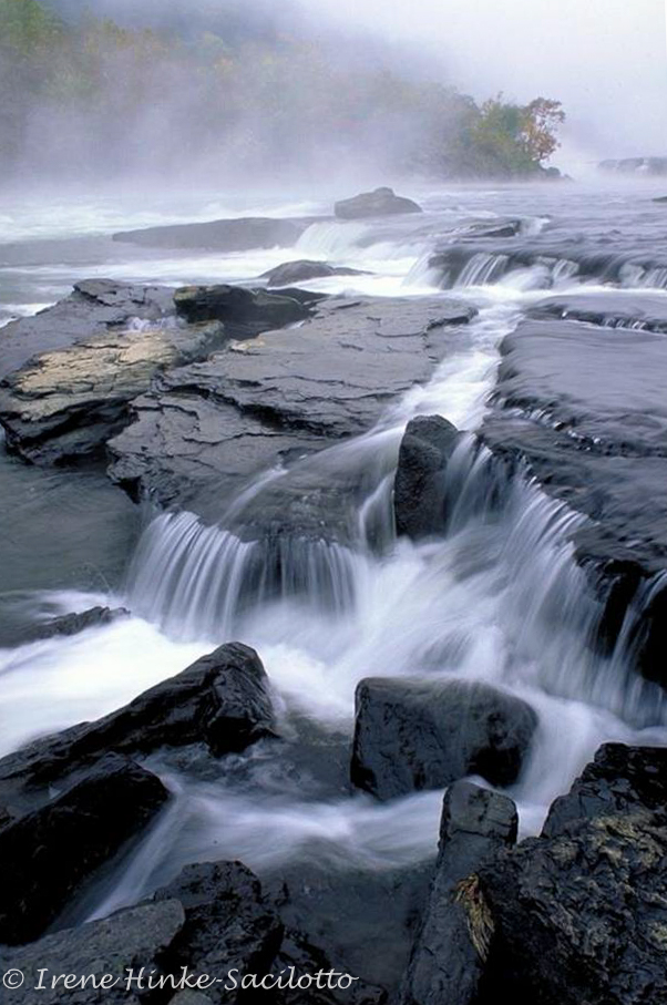
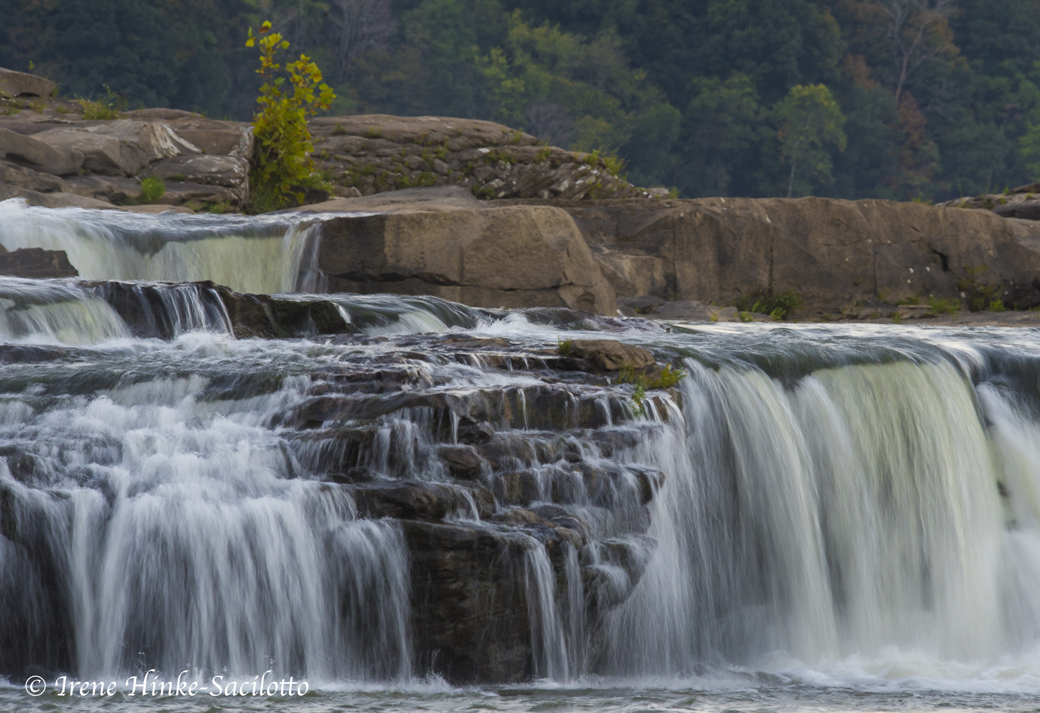
Sandstone falls shot from road in fog
Sandstone Falls
Sandstone Falls
Not far from Beckley is Grandview, a state park where there are high overlooks with views of the New River as it flows through a number of horseshoe curves. Early on fall mornings when there are abrupt changes in temperature overnight, fog often blankets the valleys. As the morning moves on, it slowly lifts revealing ghostly silhouettes of the mountain ridges and the river below. Following the trail along the canyon rim to Turkey Spur Overlook, you will find a number of scenic viewpoints where you can photograph. This park is one of the few places that I have seen a bobcat cross the road in front of me. Down stream from Grandview, the placid New River drops in elevation and becomes turbulent, cascading over boulders and ledges at Sandstone Falls. The river’s appearance varies from year to year dependent on rainfall but always offer photographers great photo opportunities. Here we will experiment using slow shutter speeds to emphasize the motion of the water.
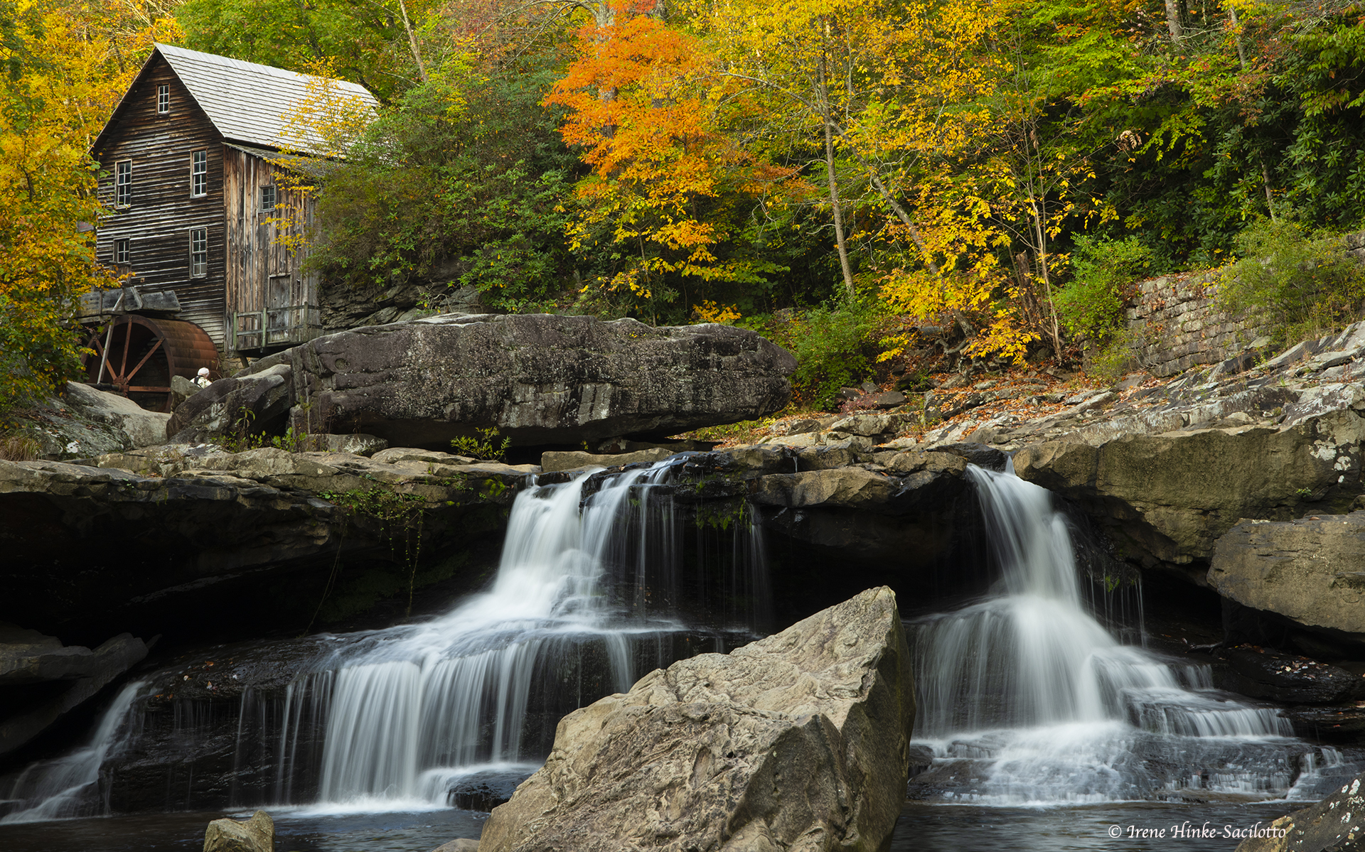
Babcock State Park & Glade Creek Grist Mill
Nearby, located in Babcock State Park is the famous Glade Creek Grist Mill, one of my favorite photo destinations. The mill sits on a cascading creek surrounded by maples and other trees that turn crimson and gold in the fall and reflect in the water below. From down stream, you can photograph this rustic scene with huge boulders in the foreground.
Glade Creek Grist Mill in Babcock State Park
Kanawha Falls
Other parks and vantage points are nearby including Hawks Nest with its unique view of the New River Gorge. Farther down the road is Cathedral Falls, just outside the town of Gualey Bridge. This small but delightful falls appears as a thin veil of water cascading down the hillside and splashing onto large boulders below. If the afternoon sun is at the right angle, the water appear as if it was liquid gold with a rainbow appearing in the mist. Nearby is Kanawha falls on the other side of the town. If time permits, we may also visit the historic town of Thurmond with a restored train station and active railroad track running through the center of town.
Railroad track running through the town of Thurmond.
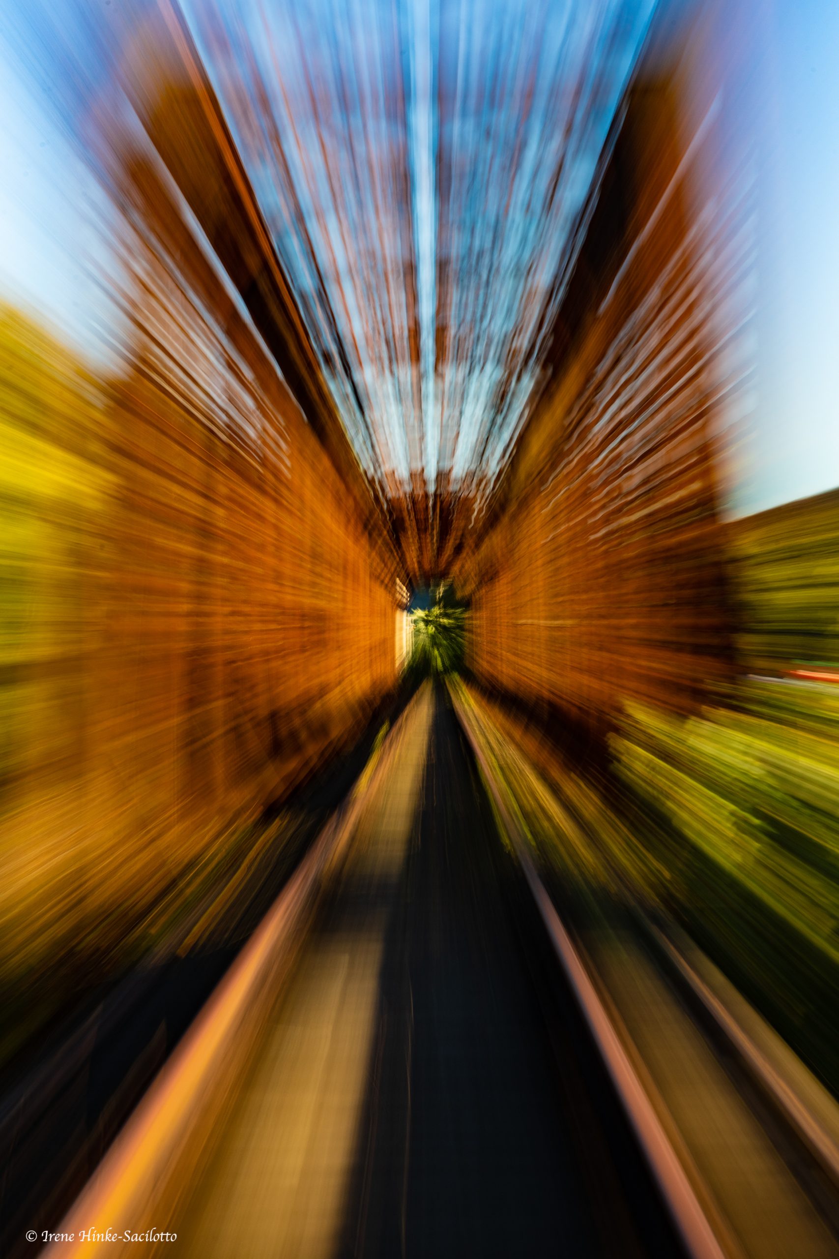
Zooming lens for old railroad bridge
Photo Opportunities
During the workshop, we will explore the areas described, hiking the trails looking for autumn color, fall wildflowers, cascading creeks, colorful reflections, picturesque overlooks, historic settings and wildlife. Deer, bear, bobcat, turkey, grouse, hawks, & waterfowl can be found throughout the area.
Reflections in a pond.
NOTES
Although the terrain in this part of West Virginia is rugged, the trails we will explore are only of moderate difficulty. Anyone can refrain from a particular activity if concerned. There will be other photo subjects nearby with easy access.
The itinerary will be adjusted in accordance with the weather, safety, traffic, park regulations, availability of subjects, and the desires of the group. This weekend was selected because it often coincides with peak fall color at both Babcock State Park and the New River Gorge.
Fall color along canyon walls.
PRICE – $ 1198 Single occupancy; $ 1078 Double occupancy
Deposit – 50 % of total (Balance due 30 days prior to start of workshop).
Cost includes instruction, park permits, and 2 nights accommodations at the Quality Inn in Beckley. Approximately a month before the workshop, I will send a handout with info on what to bring, photo tips, optional field exercises, etc. Also included will be a questionnaire so I can be better prepared to address your needs.
The town of Beckley and the hotel are centrally located relative to our destinations in order to reduce drive time to photo sites. So I can provide one-on-one assistance in the field, the class is limited to 6 participants.
Cancellation Policy
Notifications of cancellation must be in writing.
The following charges apply per person at the time I receive your written notification of cancellation:
Cancel up to 121 days prior to departure date – full refund.
120 to 61 days prior to departure, $125 administrative fee charged. ($35 admin fee for weekend workshops.)
60 to 46 days prior to departure, 50% of workshop or tour cost.
45 days or less prior to departure – NO REFUND
The prediction of bad weather and medical circumstances or emergencies do not constitute grounds for exception to the cancellation policy. Therefore, trip cancellation, interruption, & medical insurance is HIGHLY recommended. Travelers Insurance Company and others provide such policies at a reasonable rate. In the unlikely event that the trip is canceled due to insufficient enrollment, your money will be refunded in full, with the exception of expenses you personally incurred while preparing for the trip.
This Outer Banks Photo Workshop offers a variety of photographic opportunities —lighthouses, miles of pristine beaches, sand dunes, small boat harbors, historic sites, fishing piers, wildlife reserves, and parks. Over the ocean, along the shoreline, and in the marshes, waterways, and forests, we will look for photographic subjects including pelicans, herons, shorebirds, warblers, pelagic seabirds, dolphins, deer, fox,and other wildlife. Locations to be visited include Bodie and Currituck Beach Lighthouses, Roanoke Marshes Lighthouse, Duck boardwalk overlooking Currituck Sound, Wanchese Harbor, Pea Island National Wildlife Refuge, Currituck Banks Coastal Estuarine Reserve, and Hatteras National Seashore. On the Outer Banks, sunrises are often spectacular. The image below is of Avalon Pier as the sun is rising. Jennette’s Pier (1000 foot-long pier in Nags Head) also offers wonderful opportunities for photography where we hope to capture images of flying pelicans, pelagic birds, propose, surfers, and fisherman.
On 30 November there will be an orientation meeting at 7 pm, EST where participants are invited to share their background in photography and goals for the workshop. I will discuss logistics, safety, the tentative schedule, potential subjects and locations, and photo tips. Each day will begin at dawn for sunrise photography and will end the day at sunset except on Sunday, 3 December when the program will end at noon. Three night’s accommodations at the John Yancey Inn are included in the workshop price.
Note: As usual with my workshops, I will arrive several days prior to the group to access current local conditions and to scout the best locations for photography. The exact locations and times may vary according to weather, safety considerations, current road conditions, and desires of the group.
I do not photograph during the workshop so my attention can be focused on each participant.
Sunrise surf at Outer Banks, NC
Skimmer Board used at Jennette’s pier by young boy.
Surfer at Jennette’s pier
The Changing Face of Barrier Islands
The Outer Banks consists of a narrow string of barrier islands running parallel to the North Carolina coast for 150 miles from the Virginia border to Shackleford Banks in the south. A network of bridges and ferries join the islands together making it easy to travel from one to the next. The Outer Banks are separated from the mainland by bays and inlets, with Pamlico Sound being the largest (30 miles across at its widest). Like all barrier islands, those of the Outer Banks are in a constant state of flux being reshaped by the wind, waves, tides, & storms. Today’s shallow coves fill with sand and become the marshes of tomorrow. The most dramatic changes in appearance are caused by fierce coastal storms like the winter “nor’easters” and the fall hurricanes. When these storms coincide with seasonal high tides, the results can be disastrous, creating new inlets, washing out sections of the main highway running the length of the Outer Banks (Route 12) and tumbling beach-front homes into the sea. Our exact itinerary can be influenced by weather and changes in road access.
Wave with spray on windy day.
Abandon pier at sunrise.
Cape Hatteras National Seashore
For thousands of years, North Carolina’s Outer Banks have survived onslaughts of wind and sea. This thin, broken strand of islands curves out into the Atlantic Ocean and back again sheltering North Carolina’s mainland and offshore sounds. Cape Hatteras National Seashore protects long stretches of beach, sand dunes, marshes, and woodlands that are part of three barrier islands– Bodie Island, Hatteras Island, and Ocracoke Island. It extends more than 70 miles south of Nags Head.
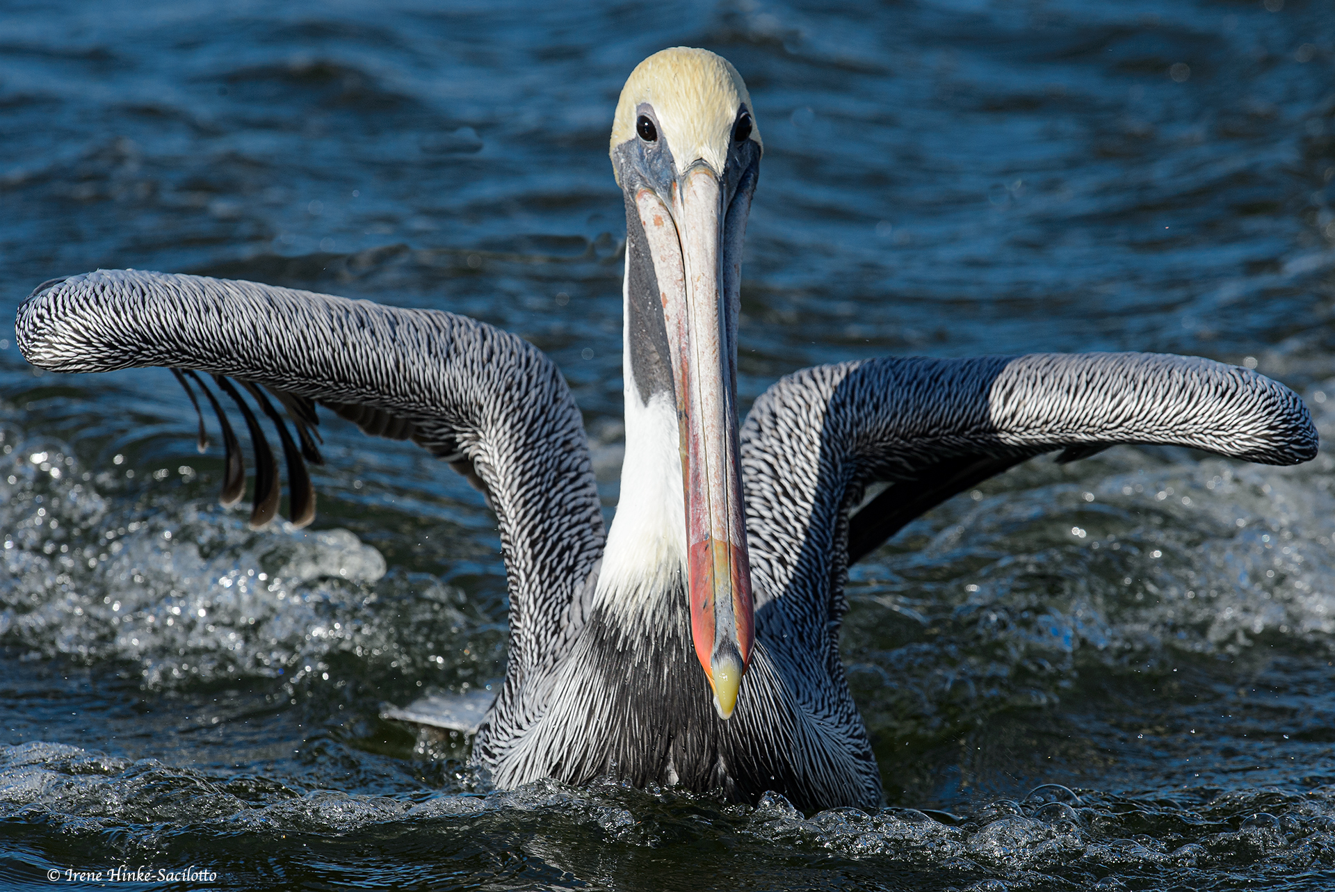
It and other undeveloped beaches, offer wonderful opportunities for photography–sunrise, waves, shells, patterns in the sand, dunes, driftwood, beach vegetation, and local wildlife. Because of strong currents and turbulence off shore, food is abundant, supporting not only large populations of seabirds, but dolphins, whales and other marine mammals. Those will longer lenses may be able to capture images of the sanderlings or other small shorebirds as they chase receding waves to feed on crabs and other tiny organisms in the exposed wet sand. Or you may have opportunities to photograph Brown Pelicans flying in formation and gliding just inches above the water’s surface or plunging head first into the ocean.
Sanderlings and Ruddy Turnstone fishing over mole crab.
Brown Pelicans fling
Oregon Inlet
Oregon Inlet connects the Atlantic Ocean with Pamlico Sound. For years, the Bonner Bridge, the longest bridge on the Rt. 12 which runs the length of Outer Banks, provided vehicle access to the southern part of the Outer Banks. Due to shifting sand, strong currents, and instability, the Bonner Bridge had to be replaced. The 2.8-mile Marc Basnight Bridge now connects the northern and southern parts of the Outer Banks.
The southern portion of the old Bonner bridge was turned into a 1046-foot long fishing pier. The Pier opened on Oct. 1, 2021 with cooperation between the National Park Service, Fish and Wildlife Service, and the North Carolina Department of Transportation. Oregon Inlet is rich with marine life due to mixing of salt water with fresh and attracts fish, birds and fisherman. From the pier, we will try to get images of pelicans, cormorants, ospreys, and pelagic sea bird attracted to the abundant food supply.
Double-crested Cormorant swelling large fish.
Near the entrance to the pier is a historic US Coast Guard station, (formerly a Lifesaving station) that has great photo potential. Near to the ocean, it sits in the midst of beautiful sand dunes.
Oregon Inlet Life Saving Station
Bodie Lighthouse & Keepers Quarters
Bodie Lighthouse
The Bodie Island Lighthouse was erected to mark the entrance to Oregon Inlet and is still operating today. It is located at the north end of Cape Hatteras National Seashore, just south of Nags Head and 4 miles before the inlet. Todays lighthouse was built 1872 after the original one on the opposite bank of the inlet was destroyed in the Civil War. It was renovated in recent years, with the work concluded in 2013. It stands 150 feet tall and has a keepers quarters is adjacent to it. It is tucked away between tall pine trees and freshwater marshland.Deer are not an uncommon sight on the main entrance road to the parking area. There are several nature trails nearby including a .4 mile long boardwalk leading to aviewing platform overlooking a pond and marshland frequented by wading birds and others species.
Osprey carrying fish.
Duck Boardwalk and Currituck Sound
The community of Duck on the northern end of the Outer Banks constructed an elevated boardwalk that is nearly a mile in length and is adjacent to Currituck Sound. Herons, waterfowl, turtles, and other species can be photographed from the various points along the walkway. It is the perfect place to capture incredible sunsets with swansor cypress trees in the foreground.
Currituck Beach Lighthouse & Whalehead
The Currituck Beach Lighthouse still functions as a guide for passing mariners. It located in the heart of Corolla near the northern end of Rt. 12, the primary road that runs the length of the Outer Banks. This 162 foot tall lighthouse stands out for its distinctive red exterior. The design was intentional to set the Currituck Lighthouse apart from its Outer Banks neighbors. The lighthouse has been left unpainted so visitors could marvel at the sheer number of bricks involved in its construction. The lighthouse is adjacent to the the Outer Banks Center for Wildlife Education, the historic Whalehead Club, and Corolla Park. The Whalehead, with its beautiful architecture, is a 1920’s mansion. Although serving other purposes over the years, it was once a secluded oceanfront retreat for this country’s wealthy hunters and conservationists.
Stairs in Corolla Lighthouse
Manteo & Wanchese
On Roanoke Island, in the late 1800s, Manteo served as an important port and is one of the oldest towns in North Carolina with large ships docking at is waterfront. A short distance away is Wanchese,another fishing port. Once centers for boat building, both ports have diminished in importance today. But they still have small boat harbors where a small number of trawlers, crabbing, and other commercial and sports fishing boats dock.
Roanoke Marshes Lighthouse
The Roanoke Marshes Lighthouse is on the east end of the Manteo waterfront. Reaches 40 yards out into Roanoke Sound with a boardwalk for access. Unlike Bodie and other lighthouses on the Outer Banks, the Roanoke Marshes Lighthouse is a replica of a lighthouse that was constructed in 1877 at the southern entrance of the Croatan Sound in the village of Wanchese to help sailors and fishermen to find their way to port. It is a river lighthouse. So like its counterparts, it is much shorter and squatter than the other lighthouses on the Outer Banks. With its red roof, black shutters, and cottage-like appearance, it is a favorite subject for photographers. The town of Manteo, one of the oldest towns in North Carolina, is quaint and worth visiting with a number of unique shops, pubs, coffeehouses, restaurants, and a boardwalk along the water. It is a nice place to pick up a coffee or sandwich after an active morning shooting session. Nearby is the small community of Wanchese with a small harbor and marina with large sport fishing boats. Usually there are a few work boats tied up at the wharf along with fishing nets, crab traps and other gear. In the past, it has been a good location to photograph ospreys and pelicans.
Crab trap with green float at Wanchese harbor.
Brown Pelican landing.
PEA ISLAND NATIONAL WILDLIFE REFUGE
Pea Island National Wildlife Refuge (NWR) is on the southern side of the Oregon Inlet and covers more than 5,900 acres. The water level is managed by a system of dikes and ponds to favor the production of food high in value to wildlife. The refuge provides a safe haven for winteringmigratory waterfowl with 25 species of ducks and more than 265 species of birds including osprey, Wilson’s plover, black skimmers, wading birds, and least terns.We will explore the overlooks and trails in search of photo subjects. In early winter thousands of waterfowl including tundra swans arrive at the refuge.
Tundra Swans flying
American Oystercatcher with mussel.
What to Bring
DSLR or Mirrorless camera, instruction manual, spare memory cards ,and batteries. Lenses from wide angle to 300 mm or more. Polarizing and a neutral density filter. Sturdy tripod. For the image review session and editing images, bring a laptop computer or tablet. Edited images should be saved to a flash drive for transferring to my computer for viewing by the group.
CLOTHING
It can be cold at this time of the year, so bring some warm clothing. But in early December temperatures can also be mild. Dress in layers. The workshop will begin each day at dawn to take advantage of the warm, early morning light. Activities will proceed in the rain, so bring rain gear and waterproof covers for your camera and lenses. At this time of year, ticks, flies or mosquitoes could still be present so bring insect repellant. For protection from UV radiation, I suggest wearing a hat and using sun screen. To prevent dehydration, bring water to each outing.
HANDOUTS
Also prior to our first meeting, please bring me on a thumb drive 2 sample images of your nature photography images for discussion. In a future handout, I will provide guidance as to file naming and formatting. Using the recommended naming protocol helps when sorting and reviewing the images besides info on what to bring. You will also be sent a liability release form and pre-workshop questionnaire that will help me to better address your needs. These should be completed before the class.
Yellowlegs after catching fish.
SPECIAL NOTES
I will provide individual attention to each participant in the field matching each their skill level. The itinerary is flexible and will be adjusted according to the location and availability of subjects, the weather, safety, group interest, and other factors. Paths may be uneven, wet in spots, or sandy. The trails I selected for the workshop are easy to moderate in difficulty. Anyone may abstain from any activity and select an alternate that is less strenuous. Boots with firm ankle support for hiking are recommended. The pace of the workshop is adjusted to the desires of the group and to allow participants to explore each location thoroughly and to ask questions. Car pooling is encouraged where possible & safe. Much in terms of health precautions will depend on the situations relative to COVID or other health risks at the time.
——————————–
PRICE $ 995 based on single occupancy; $ 870 based on double occupancy.
ACCOMMODATIONS – Price includes 3 nights accommodations (John Yancey Inn, Ocean Front, Kill Devil Hills, Outer Banks), but does not include food, transportation, tolls, any park fees or personal items.
Maximum number of participants – 6
Full payment due 30 days prior to the start of the workshop. Deposit: 50% prior to that date. See cancellation policy posted with registration form on web site. If you have questions, contact me at (410) 679-2873 or (410) 960-5871 or e-mail me at ospreyphot@aol.com
(To register, complete the form at top of the “Events” web page).
CANCELLATION POLICY
Notifications of cancellation must be in writing.
The following charges apply per person at the time I receive your written notification of cancellation:
Cancel up to 121 days prior to departure date – full refund.
120 to 61 days prior to departure, $125 administrative fee charged. ($35 admin fee for weekend workshops.)
60 to 46 days prior to departure, 50% of workshop or tour cost.
45 days or less prior to departure – NO REFUND
Medical circumstances or emergencies do not constitute grounds for exception to the cancellation policy nor does weather. Therefore, trip cancellation & interruption insurance is HIGHLY recommended. Travelers Insurance Company and others provide such policies at a reasonable rate. In the unlikely event that the trip is canceled due to insufficient enrollment, your money will be refunded in full, with the exception of expenses you personally incurred while preparing for the trip
This is Part 1 of a report on the photography along Florida’s East Coast.
The last two weeks of February I flew to the East Coast of Floridato scout for a future photo workshop in March of 2021 or 2022. In the past, I have conducted several workshops in Florida but on the west coast and in the Florida Everglades. This time, I spent 12 days visiting 18 locations along the east coast from St. Augustine to Boca Raton. Sites included wildlife refuges, state parks, zoos, gardens, and wastewater reclamation wetlands. I spent the majority of time at locations where wildlife was abundant and accessible. At other sites, I limited my visit to just enough time to evaluate the area for inclusion in a workshop.
Because of my busy lecture schedule, my visit was limited to late February. Even though it is a month earlier than I plan to offer a workshop, wintering birds were present and nesting was beginning. Breeding birds were carrying sticks, constructing nests, fighting over territory, mating, and displaying. Many wading birds displayed nuptial plumes and the color changes that come with breeding. In a few nests, chicks were present. In late March and early April, heron rookeries are much more active with screeching, hungry chicks and parents busy feeding in order to care for their young.
Sandhill Crane Feeding in field. Orlando Wetlands.
Snowy egret photographed at Orlando Wetlands
Two sites covered by this newsletter are Orlando Wetlands and Blue Heron Water Reclamation Facility and Wetland Area. These are natural and man-made wetlands fed by reclaimed wastewater, creating an environment beneficial to wildlife. Both are within a short drive from Titusville. Florida has a number of these sites with some open to visitation by birders and photographers and others are closed to the public. Some encourage visitation with boardwalks for easy access and viewing of wildlife. Several have bird rookeries within their boundaries.
Limpkin with snail at Orlando Wetlands.
What is reclaimed waste water? It is raw wastewater that has passed through a sewage treatment plant to remove solids, toxic contaminants, and some nutrients. To kill pathogens, the waste is treated with chorine which dissipates before entering the wetlands. This “reclaimed,” non-potable water is sometimes discharged into waterways or dedicated to uses like watering lawns and other purposes, but not as drinking water. However, in some cases when discharged to waterways, the nutrient loading may be high enough to create choking algal blooms which can lower oxygen levels as the algae dies and is decomposed by bacteria. Low dissolved oxygen in waterways can produce “dead zones” where aquatic animals cannot live. On the other hand, when discharged into man-made or natural wetlands, the marsh plants take up the phosphorous and nitrogen and flourish, creating environments suitable for wildlife. For sites using wetland treatment of waste, they are proactively managed and the water tested. Their condition is monitored to benefit flora, fauna, and biochemical processes. In simple terms, at both Orlando and Blue Heron Wetlands, sections of natural or man-made marsh populated with native aquatic plants are impounded and surrounded by dikes with provisions for adjusting the water level as needed. Wetland plants support large populations of tiny aquatic organisms that form the basis of a food chain that supports higher organisms. This rich supply of food acts as a magnet attracting wildlife. In addition, wetlands provide shelter and nesting habitat for birds and serve as a nursery for aquatic organisms.
Double-crested Cormorant at Blue Heron Wetlands Facility
In the case of Orlando Wetlands, you can walk along the extensive series of dike roads. At certain times, you can take a tram tour of the facility. In the case of Blue Heron Water Reclamation Wetland Area, you must sign-in & out at their administrative office on site. When I was there, you could drive selected dike roads that provided great opportunities for photography with animals at close range and use to human presence. However, for all locations that I mention in this and the following newsletter, you must check current conditions and regulations.
A number of images in this newsletter are labeled with the location where they were taken. I first visited Orlando Wetlands about a half hour from Titusville. I walked along the dike roads expecting wildlife to be far away and intolerant of my presences. I was pleasantly surprised that many animals just ignored me and went about their normal activities. Alligators, limpkins, ibis, egrets, gallinules, and sandhill cranes were within easy camera range for photography. After conducting several December photo workshops at Bosque del Apache National Wildlife Refuge where thousands of sandhill cranes spend their time from mid-November to mid-February, I was surprised to see several cranes feeding in the first field I encountered. These Florida Sandhill Cranes are resident birds that nest in Florida and don’t migrate. They are omnivorous eating seeds, insects, frogs, mice and other organisms abundant in the marsh. Near Viera Wetlands, I actually saw a crane feeding in someone’s front lawn in the middle of a development. Later I discovered that they can be found on golf courses, parks, and in other public places.
Wood Stork sitting on branch at Orlando Wetland.
To visit Blue Heron Wetlands on weekends, you must make prior arrangements. In general many of the locations I visited were closed on certain days of the week. Those providing early entry for photographers who have purchased photo passes, such as St. Augustine’s Alligator Farm and Gator World’s rookery near Orlando, limit this privilege to certain days of the week or particular months, unfortunate for me February was not included. It is critical to check each location before visiting for rules, open dates, and conditions. For example, a favorite of many photographers, Green Cay Wetlands was closed to visitation due to renovations starting in November 2019. I had visited it several years ago and was impressed with its long boardwalk and large population of nesting birds.
Great Blue Heron at Blue Heron Reclamation Wetlands exposing underside of wings.
In following newsletters, I will cover Merritt Island National Wildlife Refuge and Cape Canaveral National Seashore plus several other areas along Florida’s east coast. The pelican/spoonbill photo at the opening of this newsletter was shot on Merritt Island one morning during my recent visit.
Great Blue Heron resting at Blue Heron Reclamation Facility.
Great Blue Heron at Blue Heron Reclamation Facility.
Red-shouldered Hawk perched in tree on Blue Heron Reclamation Wetland.
Purple Gallinule Feeding ay Blue Heron Reclamation Wetlands.
Tricolor Heron stretching on Merritt Island NWR Subject of next blog.
White Pelicans and Spoonbills at Merritt Island NWR.
Chincoteague National Wildlife Refuge & Assateague Island National Seashore
Ospreys can dive to catch fish. Their feathers shed water easily and their talons specifically designed to be able to grab and fly with their catch.
Chincoteague National Wildlife Refuge and Assateague Island National Seashore
Location & Management:
Managed by the US Fish and Wildlife Service, Chincoteague National Wildlife Refuge covers 14,000 acres of beach, dune, marsh, shrub and forest habitats. The majority of the refuge is located on the Virginia end of the narrow, 37-mile-long barrier island of Assateague (Assateague Island National Seashore) just south of Ocean City Maryland. The refuge is managed to benefit wildlife and to protect critical habitat for both resident and migrating species. Birds found on the refuge include ducks, geese, heron, raptors, warblers, and shorebirds plus deer, raccoons, Delmarva Peninsula Fox Squirrels, muskrats, foxes, and otters.
In recent years, there has been a significant drop in the number of migrating snow geese visiting the refuge in the fall. Once reaching nearly 40,000, but today the numbers are much lower. Grabbed this shot several years ago as they landed on the beach. This fall, they were there again this year.
Large numbers of snow geese sometimes stop at Bombay Hook National Wildlife refuge, DE instead of proceeding south to Chincoteague in the fall. This flock circled several times before landing.
A number of impoundments have been created by refuge staff where water levels are managed to provide resting and feeding areas for waterfowl and other species. Some dikes bordering the enclosures are topped with roads adjacent to water-filled borrow ditches where birds congregate. This arrangement offers excellent opportunities to photograph wildlife from your car, steadying your camera on a bean bag or using another means of support. Because the animals are protected on the refuge and are used to seeing people and vehicles, they are less timid than elsewhere and more easily photographed.
Clapper Rails are secretive birds found in the marshes. They feed at low tide on the exposed mud flats. Rails are often heard before seen.
Wild ponies are a favorite photo subject among visitors. Smaller than standard horses with heavy coats to protect them in this harsh environment. They appear perpetually pregnant with bloated bellies from their diet high in bulk and salt.
New born. Wild pony family.
Constant Change:
As with all barrier islands, the sand shifts with the season and strong storms. The ocean cuts through the dunes sometimes forming temporary inlets. Water-laden sand rolls over the land creating new marsh. With the landscape constantly changing, there are always new and exciting opportunities for photography. No matter when you visit, you will always find something to photograph. Even in the summer when the public beach is packed with people, you can still find photo subjects by venturing out in the early morning and late afternoon when there are fewer people to interfere with your activities.
Once endangered, Delmarva Peninsula Fox Squirrels were transplanted on Chincoteague and now they are often seen at the edge of the maritime forest.
Locating and approaching wildlife:
Spotting animals requires careful scanning of the environment for shapes, tones or colors out of place, and movement. By studying animals, whether photographing or not, you gain insight into their behavior and are better able to capture action shots. Creatures of habit, animals often visit the same locations repeatedly so check these spots on a regular basis. Know your equipment well and be prepared to photograph at any time. Have a suitable camera/lens combination ready with exposure settings pre-set for conditions you are likely to encounter. Once a potential subject is spotted, plan your approach. Consider the lighting, background, subject temperament, and the animals direction of movement. If it is following a predictable path, move slowly and indirectly to position yourself where it is heading. Be careful not to cause it to alter its behavior. Rapidly moving directly towards the animal will normally causes it to flee.
I watched the direction the fox was moving and carefully position my vehicle on the shoulder of the road at a distance in front of where I thought it was going. I made sure the warm afternoon light was illuminating its beautiful red coat
After hearing its distinctive call, I spotted this Belted Kingfisher on one of its favorite branches. As I positioned my camera, it plunged into the water and emerged with a small crab in its bill before returning to its perch. To capture various poses of the bird as the bird struggled to consume the crustacean, I held down the shutter release button and repeatedly fired a series of shots using a high number of frames/second.
Shot from my car with my Nikon D850 camera and 600 mm lens resting on a bean bag. Settings: ISO 800, F10, and shutter speeds approximately 1/2000 second.
Belted Kingfisher stretched wing just before it dove after fish.
Suggested lenses and other gear:
A wide-angle for beach scenes, flocks of birds, and sunrise/sunsets and perhaps a 80 to 200 mm zoom lens to isolate portions of the scene.
A 300, 400 or 600 mm telephoto for small or timid subjects such as shorebirds. It is preferable to buy long lenses that have collars for mounting on a tripod. This makes it easier to handle the camera/lens combination and it allows for quick adjustment of orientation from horizontal to vertical or in-between.
To spot animals, I look for movement. This Cedar Waxwing was part of a flock attracted to the berries. Shot with my 600-mm lens.
A 1.4 tele-converter to extend the effective focal length of your primary lens for photographing small subjects. Note: The tele-converter reduces the amount of light reaching the sensor, cutting shutter speeds in half. For best image quality, buy one matched to your prime lens.
A 200-mm macro lens for close focusing and high magnification when photographing a shell, insect, or flower. Compared to shorter macro lenses, with the 200-mm lens, you can obtain the same magnification at a greater working distance from your subject–a benefit if photographing something timid such as a ghost crab.
Other gear: An electronic shutter release to prevent camera shake when using long exposures or high magnification. A polarizing filter to remove unwanted reflections and shine on surfaces of vegetation intensifying colors. Depending on the angle of the sun, it can also make the sky appear bluer. You might want to include a neutral density filter that reduces the amount of light entering the lens in order to create special effects by using slow shutter speeds to suggest motion of moving objects – the surf, the wings of birds, etc.
The lighting and pose made this photo of a Great Blue Heron special. Shot in the early AM.
A sturdy tripod, preferably without a center post for maximum stability when using long telephoto lenses. The tripod should be topped with a professional ball head that can easily support the weight of your camera/lens combination or with a Wimberley Head (gimbal) which is preferred by many photographers for manipulating large lenses and tracking animals and birds.
If shooting on the beach, the wind off the ocean can be fierce and unpredictable, so never walk away from the tripod. Also, watch where you place your camera gear since an incoming wave can swamp your equipment or worse, wash it away. When around blowing sand or dust, shield your camera when changing lenses to avoid particles entering the throat of the camera and making their way to the sensor resulting in dark spots on your images.
Willet picking up mole crab. Shorebird behavior is often predictable. They follow the edge of the surf, probing for organisms as waves retreat.
Useful tips:
By having with you two cameras mounted with different lenses when in the field, you can avoid changing lenses in the open and can more quickly switch from one focal length to another.
When on the beach, wipe or brush the sand off your tripod legs with a damp cloth to prevent particles and salt from entering the joints between tripod segments and making it difficult to adjust the tripod’s height. You can buy or create water-proof tube covers for the lower legs to minimize sand-related problems and to allow you to submerge the legs in the surf.
If visiting in the spring, summer or early fall, bring insect repellant to guard against mosquitoes, biting flies, and ticks potentially carrying Lyme disease. Reads more on CDC’s website. https://www.cdc.gov/lyme/prev/on_people.html
Adjacent to the refuge is the town of Chincoteague with a small boat harbor. Sometimes loons are found here. It is also a good place to photograph sunset.